
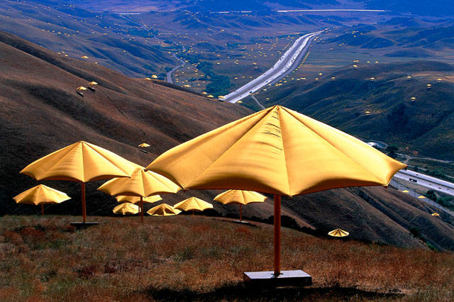
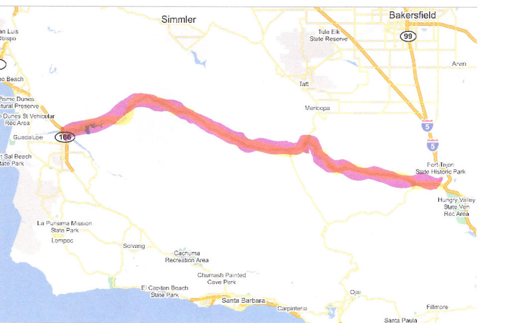
High up on the mountains between Los Angeles and bakersfield, along the I-5 and where Christo set up his yellow umbrellas, there is a road that heads east into Mount Pinos, a recreational area. Mount Pinos is not the point of this story, the story is the road itself. A one lane road that meanders through the hills and mountains, between pine trees, green lush valleys and gorges with high rocky cliffs. You can get lost in the scenery and would not believe that you are a mere 3 hours from one of the major metropolis of the world, Los Angeles.
It is a one line road which if you folow from the Intersate 5 to its end, you will end up on PCH. Or Pacific Coast Highway. San Jose to the North and Santa Barbara to the South. The town that you arrive at is Santa Maria. (Made famous by the owner of Neverland Ranch).
I first took the road back in 1990 or '91, back when my then "future wife" and I were dating. One of our favoprite things to do was to get in our car and just drive. No destination. Of course living in the L.A. area, there are plenty of destinations. That was how we found this road. We had talked about going to Santa Barbara for the day. Rather than take the easy and fast road (PCH) we decided to look at a map and find a different route.
That is how we found this lonely road, which according to the map, would "take us" North of Santa Barbara.
I remember it was winter-cause we drove through some snowed areas in the mountains, at times we wanted to turn around, but our adventurous spirits told us to just go on. Besides, we were driving a Blazer, so we "trusted" it.
It turned out to be a wonderful drive.
From the I-5 you go up into the mount Pinos area, there is a village as soon as you get off the road. as you drive further into the mountain, you observe log cabins and some very expensive mountain homes. the read continues up and very soon the houses and cabins dissapear. The road takes a sharp turn to the right and into the hillsides. There are shome sharp turns and here and there, you see hidden driveways that lead to some cabins deep in the woods. Sometimes you can make them out, but most of the time all you see are the hidden roads.
This road continues for a good 30 miles. There are points at which no sign of civilization, other than the road, is observed. No cars go by and all you hear is the wind and birds. After all that drive you get to the "top" of the mountain (See First picture above) From there you can see the valle bellow. Further north, is Bakersfield-you can't see it in the picture.
Continuing on this road, which now traverses gentle rolling hill reminiscent of Northern California, you can now see ranches here and there. You will also see a sign that indicates that it is a California Condor Reserve area. The road becomes flat and straight. (To be continued)
3 comments:
you know, the way you describe things shows, you must be an awesome story teller!
que hermosas fotos!!!
After reading this post I realized it's been a while since I went on a road trip in hopes of discovering more of California's hidden beauty.
Post a Comment